


Transportation information for Jersey City is provided below. Travel information includes driving directions, maps, airport information and more.
Transportation Services
Diamond Logistics Express
- Cranford
- Transportation Services
- 908-325-6079
Avalon Transportation
- North Arlington
- Transportation Services
- 800-910-5466
Prestige Car Service
- Bronx
- Transportation Services
- 877-665-6947
A Class "A" Ride
- Garfield
- Transportation Services
- 201-647-6153
Shamrock Stagecoach
- Keansburg
- Transportation Services
- 732-787-1113
Accessible Vans of America
- Fairfield
- Transportation Services
- 973-439-9390
Central Jersey Transportation
- Toms River
- Transportation Services
- 732-703-6595
Airport Taxi & Limo Service
- Iselin
- Transportation Services
- 732-283-2420
E Z Trans Inc
- Linden
- Transportation Services
- 908-862-1000
Green Integrated Logistics Inc
- Ridgewood
- Transportation Services
- 201-444-3734
Apolo Taxi
- Passaic
- Transportation Services
- 973-777-7787
New Laconia Radio Dispatcher
- Bronx
- Transportation Services
- 718-798-2222
Coach USA
- Westwood
- Transportation Services
- 201-263-1254
New Jersey Transit
- Wayne
- Transportation Services
- 973-628-0192
Ace Taxi & Limousine
- Jersey City
- Transportation Services
- 201-222-9952
Right Time Limo and Car Service
- jersey city
- Transportation Services
- 201-451-5466
New Limo
- Jersey City
- Transportation Services
- 201-333-4567
Preferred Limousine & Car Service
- Manahawkin
- Transportation Services
- 732-353-3024
AA1lyndhurst cab
- Rutherford
- Transportation Services
- 201-531-0517
Kingsdale Car Svc
- Bronx
- Transportation Services
- 718-796-2222
Paterson Express Taxi
- Paterson
- Transportation Services
- 973-357-1212
Adams Limo and Car Service NJ
- Westfield
- Transportation Services
- 908-322-0802
Fleet Car Carriers
- Ridgefield
- Transportation Services
- 201-313-4930
Coach USA
- Paramus
- Transportation Services
- 201-845-4698
taxi express service
- paterson
- Transportation Services
- 973-742-4700
Plus One Limo & Car Service
- Jersey City
- Transportation Services
- 201-332-4444
New Concepts Limousine
- Hazlet
- Transportation Services
- 732-787-3013
Adams Limo and Car Service NJ
- Short Hills
- Transportation Services
- 973-218-1088
EVERGREEN CORP CAR & LIMO SERVICE
- Jersey City
- Transportation Services
- 201-217-0070
Eurostar car Service
- Maplewood
- Transportation Services
- 973-275-0505
Airportaxicablimo
- Rochelle Park
- Transportation Services
- 201-655-0750
Velvet Transports
- bronx
- Transportation Services
- 646-801-0838
Miles Private Cars Inc
- Bronx
- Transportation Services
- 718-884-8888
ABC Taxi Dumont
- Dumont
- Transportation Services
- 201-385-0600
AJ's Express Car & Limo
- Jersey City
- Transportation Services
- 201-424-2323
L & K Sedan & Taxi Service LLC
- Kenilworth
- Transportation Services
- 908-223-8508
TXX Service Inc
- Carlstadt
- Transportation Services
- 201-728-9581
clifton taxi a1 ride
- Clifton
- Transportation Services
- 973-928-2200
Rockland Coaches
- Bergenfield
- Transportation Services
- 201-384-0457
JERSEY CITY TAXI & LIMO
- jersey city
- Transportation Services
- 201-432-6111
Greenway Logistics
- Springfield
- Transportation Services
- 973-376-4607
Scooter's Taxi
- Woodbridge
- Transportation Services
- 732-634-1800
Vogel Bus Company
- Roselle
- Transportation Services
- 908-298-0045
Villani Bus Company
- Linden
- Transportation Services
- 908-862-3333
Airports
The Newark Liberty International Airport is one of the most highly trafficked airports in the country. All major airlines provide service to the airport which allows for easy access to the city. The airport is located between the New Jersey Turnpike, U.S. Route 9, U.S. Route 1 and I-78.
RV Rentals
Luxurious RV Rentals Nationwide
- West Palm Beach
- RV Rentals
- 800-561-8538
Map + Directions
Basic Directions
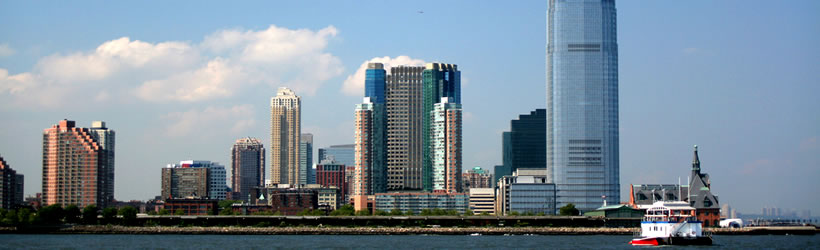
Jersey City is located between Hoboken and Union City along the Hudson River. It is served by the New Jersey Turnpike, I-78, and U.S. Highways 1 and 9, as well as New Jersey Routes 139 and 440. The Holland Tunnel connects Jersey City to New York City and NJ transit is the most popular mode of transportation for getting in and out of the Manhattan.

